
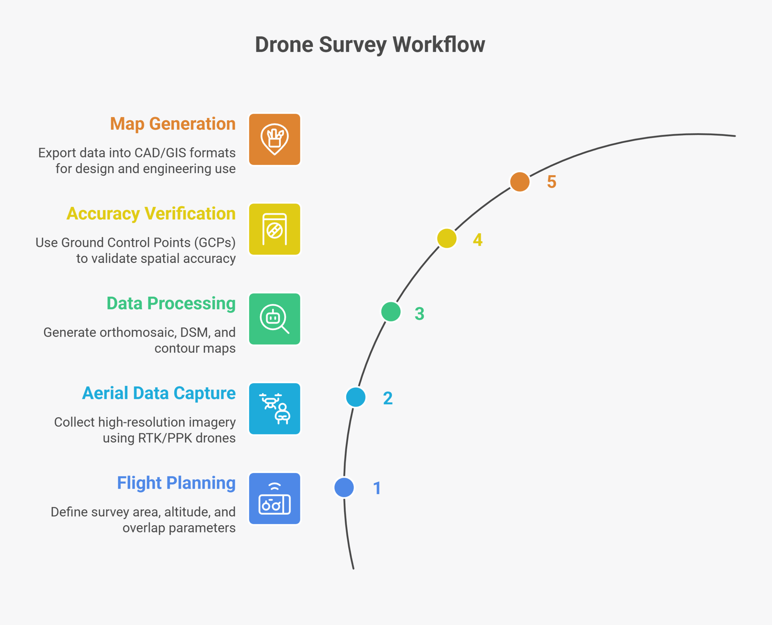
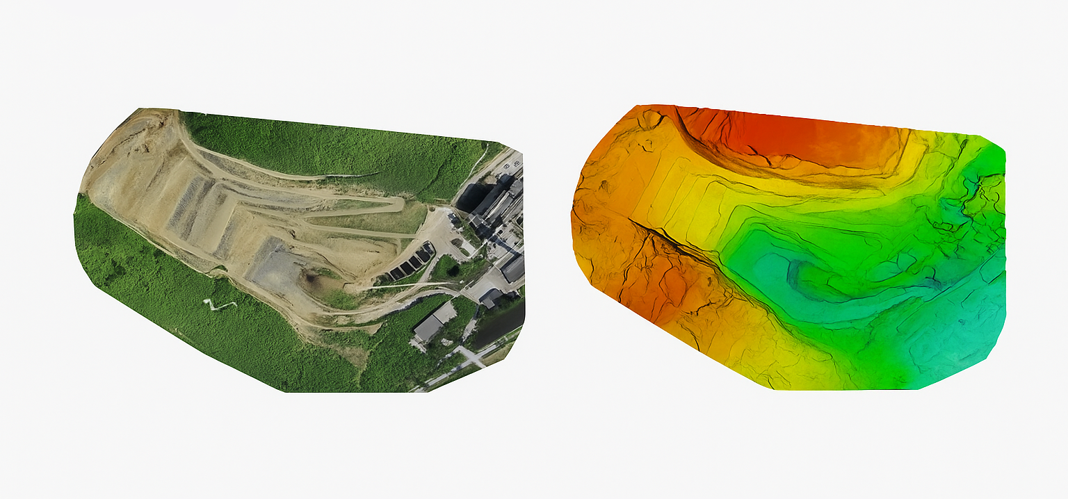
Topographic drone surveys enable rapid and accurate mapping of terrain elevation, contours, and surface features.By capturing overlapping aerial imagery and processing it through photogrammetry or LiDAR, drones generate detailed Digital Elevation Models (DEMs) and contour maps essential for construction, infrastructure planning, and land development. This method dramatically reduces field time while improving precision compared to traditional total-station or GPS surveys.
| Deliverable | Format | Usage |
|---|---|---|
| Orthomosaic Map | GeoTIFF | Base map for design |
| DSM / DTM | LAS / GeoTIFF | Elevation and slope analysis |
| Contour Map | DWG / SHP | Engineering design reference |
| Survey Report | PDF / CSV | Project documentation |
| Parameter | Typical Accuracy | Depends On |
|---|---|---|
| Horizontal Accuracy | ±2–3 cm | RTK/PPK setup, GCPs |
| Vertical Accuracy | ±5 cm | Terrain, sensor calibration |